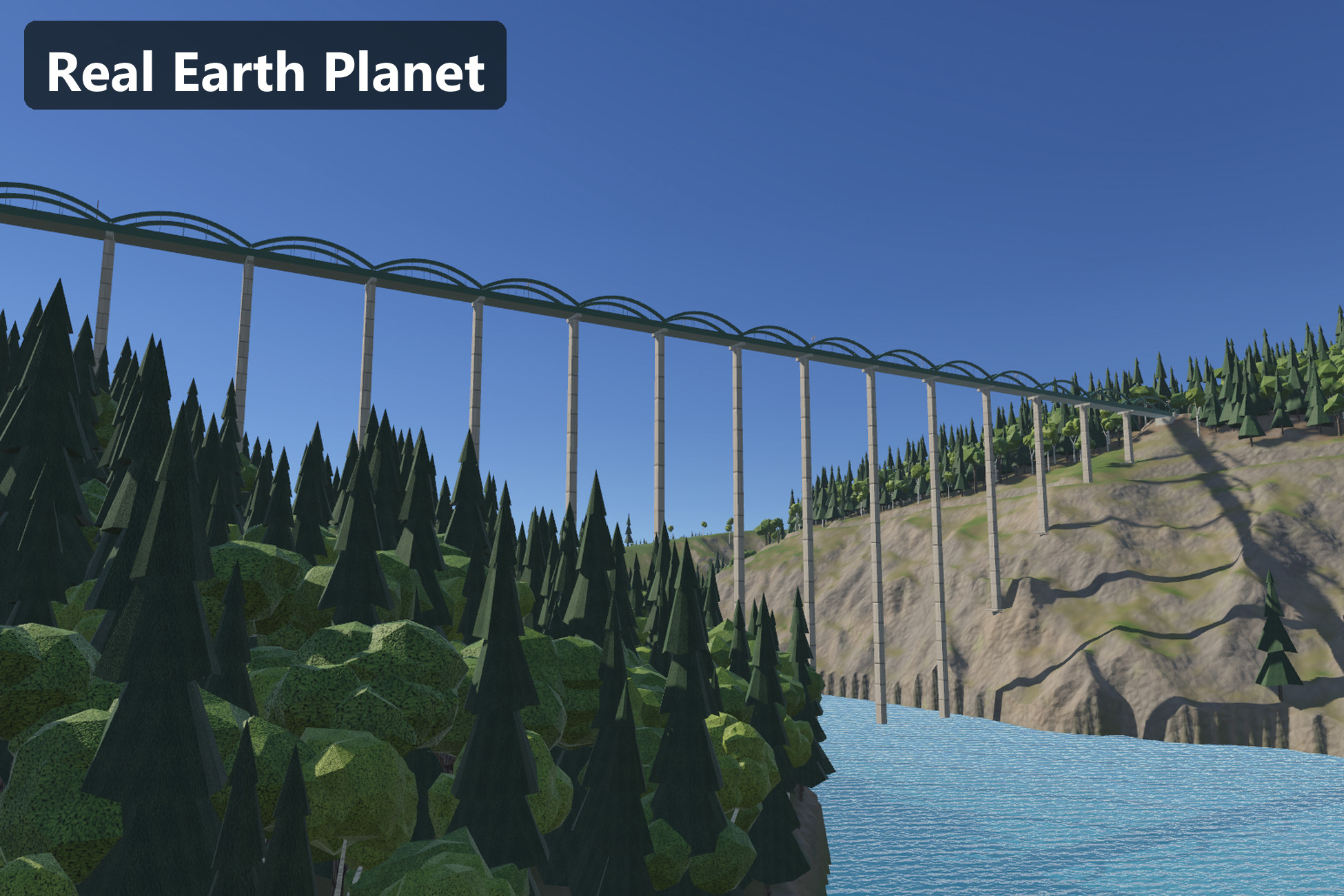
Click a place on a turning globe and get the real place in Unity: its real terrain at 1 m resolution, its real railway and roads laid with bridges, viaducts and tunnels, its rivers, lakes and forests — fetched and built at runtime. For the Universal Render Pipeline (URP) in Unity 6.3 (6000.3.21f1).
Choose a country, click a place and press Generate. Real Earth Planet downloads that place's elevation and its OpenStreetMap data on the spot, builds a 2 × 2 km Unity Terrain, plans the railway and the main roads over the real ground with Real Roads & Tracks 1.0 (included), carves the rivers, fills the lakes and plants the forests. Nothing about any place is stored in the package, so the whole planet is available without gigabytes of downloads. A region you built once comes back from the disk cache without the network.
Watch the overview:
https://www.youtube.com/watch?v=BrLMFcOjHY0
Five real places, ready to fly over
- Landwasser Viaduct, Switzerland — the Albula line crossing the gorge into the Landwasser tunnel, on 0.5 m swissALTI3D lidar.
- Garabit Viaduct, France — the 565 m railway viaduct over the Truyère reservoir and the A75 motorway bridges.
- Glenwood Canyon, USA — both I-70 carriageways through the 1.2 km Hanging Lake Tunnel, the Union Pacific line and the Colorado River.
- Kalte Rinne, Austria — the Semmering railway over the Kalte Rinne viaduct and through the Polleros tunnel.
- Loreley, Germany — both Rhine railways with their tunnels, the B 9 and the Rhine itself.
Each place is a checked entry in a plain C# table: its heights were compared with independent official point heights (within about half a metre where one exists) and its OpenStreetMap bridges and tunnels were checked against the built result. Add your own places the same way — any latitude and longitude works.
A globe you can pick from
- A turning Earth with day and night maps, city lights, clouds, an atmosphere rim and stars.
- Hover a country to highlight and name it, click to select it, click inside it to choose a place. The region box is drawn to true scale on the globe.
- One input path for the mouse and for your own code; events for "country selected", "place chosen" and "generate requested". uGUI interface, no IMGUI.
Real data, on demand, without keys
- Elevation from Mapterhorn terrain tiles: national lidar where it exists (for example 0.5 m swissALTI3D in Switzerland, 1 m USGS 3DEP in the USA, 1 m IGN RGE ALTI in France, 1 m BEV in Austria, 1 m DGM1 in Rhineland-Palatinate) and the global 30 m Copernicus base elsewhere. AWS Terrain Tiles are the automatic fallback.
- Roads, railways, waterways, lakes, forests and bare rock from OpenStreetMap in one Overpass query per region.
- No account, key or token for the defaults. Every endpoint is configurable, so a shipped game can use your own servers.
- A disk cache, at most 4 requests at a time, polite back-off when a server is busy, and every request logged.
Real terrain, real railways
- A 2048 × 2048 m Unity Terrain at 2049² (1 m cells) in an exact local frame: world metres are real metres. A 16 km horizon ring around it.
- The railway and the main roads are planned over the real ground by Real Roads & Tracks, held at the heights of the OpenStreetMap bridges and tunnels: viaducts over gorges, tunnels with fitted portals and terrain holes, cuttings and embankments within real grades. More lines per region where the place has them (both Rhine railways, both I-70 carriageways).
- Earthworks are capped so portal and bridge-end fills never wall off a gorge.
- Rivers are carved with a surface that only ever runs downhill; wide rivers mapped as areas (the Rhine, the Colorado) get a surface that falls with the river; lakes are levelled.
- Ground painted from slope, altitude, OpenStreetMap areas and the track corridors, drawn by a URP terrain shader built against visible tiling: hex tiling with rotation, a far texture scale, triplanar rock on cliffs, macro variation and grass colour patches.
- GPU-instanced fores
Description sourced from the Unity Asset Store listing.